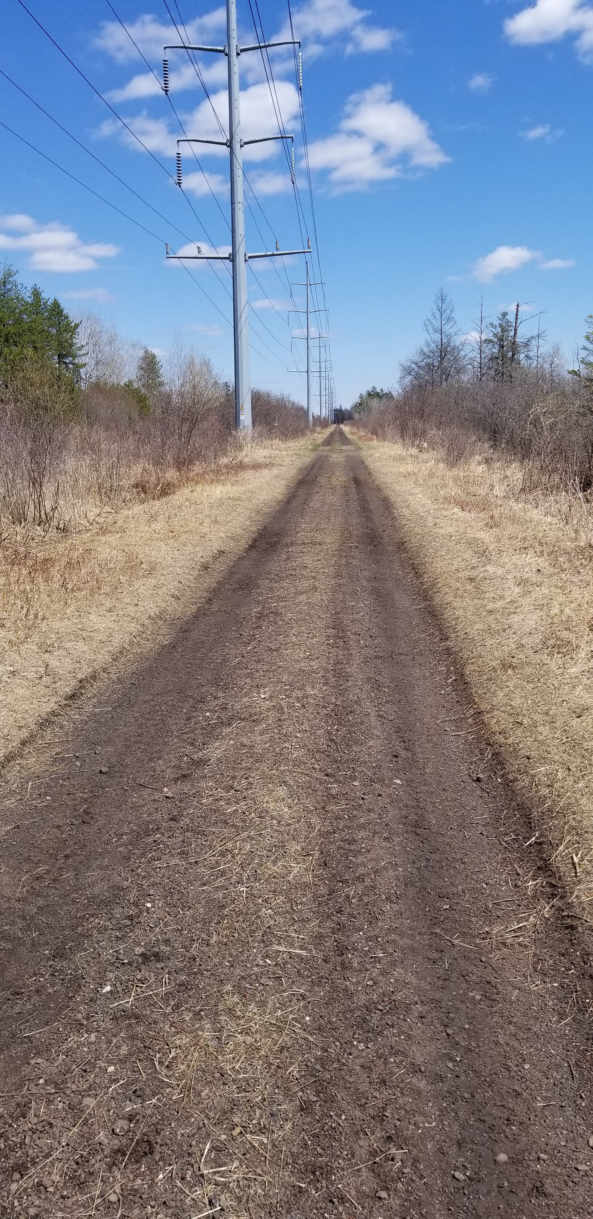
Zigzag

the letter Z

Distances in the Grand Canyon are described in various ways by those who have hiked them frequently. There are straight line miles, “as the crow flies” miles, and the miles spent zigging and zagging, as Colin Fletcher called it.  From “The Man Who Walked Through Time”,

“Cross-country on foot, miles are always misleading: the hours are what count. In the Canyon, miles become virtually meaningless. From start to finish of my journey I would cover, in a straight line, only forty-three. The river mileage came to one hundred and four. When I ran the map measurer from one end to the other of my proposed route, carefully following each winding contour, it registered just two hundred. But I felt sure, and Harvey Butchart greed, that I would walk at least four hundred miles as the foot slogs. And there were times when I would be lucky to travel half a mile in an hour.”

Another word, switchback, is often used to describe hiking trails and roads that go up or down steep hills. The trail will go in one direction up the hill, turn 180 degrees and continue uphill in the opposite direction, and repeat until the hill is climbed. The main purpose of this zigzag process is to protect the hill, and the trail from erosion. It is also a way of controlling the grade for ease of hiking, although it makes the distance considerably longer.

Almost every place I’ve hiked has been in hilly or mountainous terrain. Often there are switchbacks and there will also be signs to stay on the trail and not take shortcuts. Shortcuts that go straight down the hill will get worn down and become a path for rainwater to follow, producing erosion and eventually the trail will be ruined. It’s tempting at times but I’ve learned not to take those shortcuts.

The descent into the canyon includes so much vertical distance in such a short space that there will be a lot of zigzagging, especially on the South Kaibab. The picture below is of a section of the Bright Angel Trail, the upper left corner and lower right corner have a lot of visible switchbacks. Looking at this picture makes me think this is going to be a long, grueling climb. What fun! I can’t wait. The word zigzag is interesting because of the z’s which sort of mimic the shape of a switchback. 

portion of Bright Angel Trail, Grand Canyon
Switchbacks on the Bright Angel Trail (most visible at top left and bottom right)
photo from canstock.com by Kelly Vandellen

We are at the end of the alphabet once again. The A to Z is a valuable writing experience for me, but more than that, it is a joy to meet others in this online blogging community. I am always amazed at the creativity, the sharing of comments and encouragement, the friendship extended, and the way it is all shared through the written word. Thank you to everyone who read and commented, and to the organizers of the A to Z. It has become my April habit.

YIZI GO

YIZI GO This is a portable camp chair made by Trekology. Who knew that I needed a camp chair? According to the hike guidelines it is nearly a necessity, listed in fourth place, right after tent. They must have anticipated my skepticism because they also listed their reasons, “Canyon surfaces are invariably hot, cold or uncomfortable to sit on”.  Okay.

So, I dutifully went online and spent four hours reading reviews and looking at camp chairs. What a job!

Do I want it to be light enough to carry for miles, or do I want it to be strong enough not to break when I sit on it? If I believe reviews, it’s one or the other, not both.

My chair, here it is.

I decided on the YIZI GO. Do you know why? Yes, so I would have a pretty cool subject for the letter Y. No kidding. It also turned out to be a good buy and I feel favored in my choice. I put it together a couple of times and once I learned how, it wasn’t as hard as the reviews indicated. I sat in it and it was comfortable. It has adjustable legs so it can be a little higher than some, and yet it is lighter than quite a few of the models. I like that it has a little pocket, a carry sack, and a ground tarp (had to order this extra) so the legs don’t sink into the dirt.

There are so many interesting pieces of equipment that are tempting to buy. I have a hard time getting out of stores that sell camp equipment without getting something. But this was the only one that had a really useful name. We all have our reasons… just sayin’.

Why?

Why?

Do you ever wonder why you are drawn to adventure? Even if you only like to read about adventure, discovery, exciting lives and times, have you stopped to think about why those stories are appealing? Why do we have bucket lists? Why do we purposely choose some challenges and count them worth the pain they may cause? Why do I want to sleep on the ground for five nights, hike 20 miles up and down a distance greater than four Empire State Buildings, in uncertain weather with only what I can stuff into one duffel bag, and do all this with 7 strangers who might snore even worse than I do? Why?

My thinking – it’s because we are made in the image of an adventurous God. Big plans, big ideas, a view of existence so broad and all encompassing that we can’t begin to understand it, all that starts with him. It’s mystery and we are made to be curious and to seek it out.

The Grand Canyon is a project on a scale bigger than we can imagine, yet the processes that formed it were designed and patiently overseen.  Colin Fletcher in “The Man Who Walked Through Time” was trying to wrap his mind around the length of time represented by the Grand Canyon – millions of years.  He had this to say, and I quite agree.

 “Most of us, when we first think deeply about such time spans, tend to draw back in fear from their brink, just as we tend at first to draw back in fear from the brink of anything so immense as Grand Canyon. But it is worth remembering, I think, that some element of fear probably lies at the root of every substantial challenge. And it makes no difference at all whether the challenge is to your mind or to your body, or whether – with richer promise than either, alone – it embraces both.”

The Man Who Walked Through Time, p. 4 by Colin Fletcher

That fear thing! I will admit to being drawn to things that are capable of frightening me.  Isn’t that the essence of challenge? I am habitually choosing challenges, small, large, and in between, because I want to know if I can prepare well enough, mentally and physically.  The prospect of seeing and experiencing wonderful things that I would otherwise miss pulls me into adventure.

My adventure is somewhat ridiculous when compared to Colin Fletcher’s goal of walking the Grand Canyon from one end of the park to the other, but another quote from him resonated strongly with me.

 “I looked east and west, as far as my eyes could strain, until cliff and terrace tapered way into hazy distances. It was mysterious and terrible – and beckoning. And some time during the afternoon, as I sat on the rink of this strange new world, it came to me that if a route existed, I would walk from one end of the Canyon to the other. Once the idea had crystallized, no hideously sensible doubts reared up to plague me.  And I did not need such fragile props as “reasons”. The only question I asked myself was whether the project would turn out to e physically possible. Perhaps it is in this kind of simple certainty that most of the world’s ridiculous and wonderful dreams are born.”

The Man Who Walked Through Time, p. 6 by Colin Fletcher

Hmm… I know what he means by “hideously sensible doubts” and from time to time they may plague me.  But sometimes, like with this Grand Canyon thing,  a challenge just comes to me, from out of nowhere, and if it’s physically possible to do it, I don’t need reasons. Just sayin’…

Trekking Poles

On most of my long hikes, somewhere along the way I’ve found a stick I could carry and lean on.  On one of the Appalachian jaunts I picked up a ridiculously heavy branch and kept it because it had a natural hand grip that I liked. It has been varnished and is where I keep all my hiking stick badges – the kind made of metal that you can nail on.  It’s pretty but not very practical.

But now I am happy to report that I have real trekking poles. I’ve only used them once but I was very happy I had them.  They are like having an extra arm, or maybe an extra leg to support, share the weight, and give balance. It’s definitely worth looking at what’s out there and getting some poles if you are going to do a lot of walking on uneven ground.

I searched in all the usual places – Amazon, REI, sporting goods stores – and finally found a company called Montem, that makes trekking poles and, well… pretty much just trekking poles! It’s their area of expertise.

Trekking poles should be strong and light, adjustable in length, and have comfortable hand grips. I’m very satisfied with mine. I chose hand grips made of cork because I thought they looked cool because they are soft, and somewhat absorbent when my hands get sweaty. The adjustable length feature has strong locking clamps that hold well, and they will telescope down to a length that fits in a suitcase. That’s very handy when you fly somewhere to hike.

Close up of adjusting mechanism and hand grips.

I’m sure that the poles will really help on this hike, especially on the knee jarring descent. My brother, who knows, told me so. I’m going to believe him.

Have you tried using trekking poles for a hike or even a long walk around the neighborhood? You never know when you’re going to have to fend off a stray dog, or need to poke something. Might as well have a good pole, just sayin’…

South Kaibab Trail

We are on the homestretch of the A to Z this week with only eight letters to go. As in hiking, this final stretch is going to be challenging since I no longer have posts written ahead and am getting tired (and would rather enjoy spring outside than do writing inside). It feels like uphill all the way…

The South Kaibab Trail is the one my hike will start on – they call it a corridor trail, meaning that it is one of two or three that is regularly patrolled and maintained. It is part of the Arizona Trail system going all the way from Mexico to Utah.

After our first day of having our gear checked over and learning about the area we will walk through, I’m guessing we will meet early at Bright Angel Lodge and take the first shuttle bus of the day to the trailhead. It’s a ways away from Grand Canyon Village and there is no parking there for private vehicles. We will start our descent of 4,700 feet over the next seven miles. We will meet mules and other hikers on the trail. There are a couple restrooms on the way, but no water sources until we reach the bottom of the canyon. About the only shade will be from the canyon walls. The grade will be as steep as 22% at the final section and there will be many switchbacks. Doesn’t that sound like fun? But wait, it’s worth it.

There just aren’t a lot of ways to go down these amazing cliffs.  The South Kaibab was supposedly built to foil Cameron who had started charging $1 per person to use the Bright Angel Trail. It is steeper and shorter but has some of the most amazing views available.

  • One of them is .9 miles on the way and is called Ooh-Aah Point, because that is what most people say when they get there. I’m going to try to say something more original. It’s a good distance for a casual day hike.
  • Next is Cedar Ridge at 1.5 miles, another good point for day hikers to turn around.
  • Followed by Skeleton Point at 3 miles, where there is reportedly a 360 degree view of the canyon, and the first view of the river.
  • Followed by Tip Off at 4.6 miles where the steepest section of switchbacks starts, taking us down to the Black Suspension Bridge, Bright Angel Camp and Phantom Ranch. 

Although it is described as knee jarring, it is all downhill, right? I think I can do it.

The river – there it is!

Qabab

Yes, it really is a word. It is the name of a dish consisting of pieces of seasoned meat. However, it has nothing to do with the Grand Canyon. I’m hoping the alphabet police won’t notice I’m going off theme.

I could only come up with one Q word having something to do with the canyon and that was quartz.  I didn’t even want to try to make quartz an interesting subject, although I’m sure some would be able to do that. So instead I chose qabab, which interestingly, is kind of like the Grand Canyon word Kaibab – that’s my excuse. There’s not a lot to tell about qabab either, except that it is more commonly spelled kebab. Shish kebab. We all know what that is and have probably enjoyed those seasoned pieces of meat roasted on skewers with vegetables stuck between them.

What I would really enjoy writing this post about is this A to Z exercise of researching my coming adventure.  It has been so helpful to me, as I learn ahead of time about the things I will be seeing and experiencing.

In some ways, it has dispelled the fear of the new and unknown. I have looked at the details of the trails I’ll be walking. The history of the buildings, the inhabitants of the area, the development and tourism aspects, the geography – all of it is a bit familiar now.  I’ve thought through all the travel arrangements and rehearsed mentally what each day will be like. Some of it may turn out differently, but I at least know one way it could turn out.

The only unusual and unexpected result from my posts has been comments from friends and relatives who are now worried about me going on this hike.  I am having to explain why I would want to do such a thing. The husband looks at me and says “you’re not 25 anymore, you know”.  It’s like people are thinking I’m going to run my wheelchair off the edge of the trail.  I’m not going to start having second thoughts about this – that’s my story and I’m stickin’ to it.

And as long as my Q word is unrelated to the Grand Canyon hike, I thought I’d post a couple pics also unrelated to the Grand Canyon. They are from my first extended hike on the AT with four lovely young women. Now that was an adventure. The first one was taken by the gentleman who gave us a ride to our starting point (we hiked back the 30 plus miles to our car). Our packs were so heavy, and we were so “green”. I’m sure he thought we would never make it. But we did.

Julie, Maura, me Esther, Kim
Me in my dork costume.

The countdown has started, 24 days to go… I CAN’T WAIT. Well, I can, but you know what I mean. Just sayin’…

Phantom Ranch

Phantom Ranch is an exclusive place that I have been hearing about for years and have always wanted to visit. Exclusive it is, because there is a quota on how many people can get reservations there or in the campground in a season. There are no other places to stay in the canyon, except for hikers who have back country permits to pitch a tent elsewhere. There is a lottery reservation system and it has a 13 month advance timing. If you are randomly chosen and your requested dates fit open accommodations, you get to stay. If not, you start over.  This one of the reasons why only 1% of the millions of visitors to the canyon in a year will get to stay at Phantom Ranch.

The ranch is at the bottom of the canyon at the intersection of the Bright Angel Trail, the Kaibab Trail North and South, and the Colorado River. The buildings were designed by Mary Elizabeth Jane Colter (what happens when your parents can’t decide what to name you) and built in the early days of tourism to the canyon. They are really beautiful stone and timber buildings that almost disappear into the surroundings. When the designs were approved the plan was to name the buildings Roosevelt Chalets but Ms. Colter said “not if you want to use my design”. She had already named it Phantom Ranch and that’s what it stayed. The rich and famous rode mules down the trail and stayed there, sometimes for weeks. There are cabins housing from 2 to 10 people, and 2 dormitories for males and 2 dormitories for females. Dorms have five bunk beds each and a common shower and restroom.

Meals are served at the Ranch by reservation also. They are rather expensive but that is understandable when you realize that almost everything that comes and goes to the ranch has to do it by mule. Breakfast goes for about $24 and the early seating is at 5:30 am. If you like to sleep in you can catch the late seating at 6:30 am (hmm…). My food will be carried in my pack to the campground by mule so I have no reservations for a meal at the canteen, but I may stop in to buy a postcard or a drink while I’m there.

Bright Angel Campground where I will be tenting for two nights is only a short walk from Phantom Ranch. On this “in between” day we will be doing some day hiking along the river and some side canyons. I’ve heard this is supposed to keep us from getting stiff and sore before the hike back up to the rim again. We’ll see.

Approach to Phantom Ranch

The Park Service has a lovely video of Phantom Ranch and detailed instructions for the lottery reservation system at http://www.grandcanyonlodges.com/lodging/phantom-ranch/

Photos from canstock.com

Oh, What Shall I Wear?

Oh, what shall I wear (that doesn’t make me look like a dork)?

I have photos of all my most memorable hikes. Most of them were taken by me so I am not in them (before selfies) but the ones I am in are always a little embarrassing. Some people look really cool when they’re hiking (and that is SO important) but me, not so much. I just don’t look like I know what I’m doing.

This hike might be different, although I’m not going to bet on it. I’ve had time to prepare and get some real hiking clothes. I justify it more on the practical side so I don’t appear totally vain and superficial. The right hiking clothes do make a difference in comfort, and I have listened to people talk about comfort a lot.

I’ve already shown you about the weather extremes that are possible in May (in post E) so you know that layering on top is going to be important. I also value things that breathe, dry quickly, and are stretchy to allow me to move. I love pants with good pockets, that will not look dirty even if I wear them all three days, and are somewhat water resistant. With these things in mind here is my list.

  • 2 short sleeve T shirts
  • 1 long sleeve T shirt
  • 1 fleece pullover
  • 1 rain jacket (which I might leave behind if the forecast is for no rain)
  • 1 pair convertible pants/shorts
  • 1 pair long pants
  • Socks and underwear
  • Brimmed hat and bandanna
  • Warm hat and gloves

I already wrote about my hiking boots and socks, but I’ll also take along a pair of lightweight camp shoes to give my boots a rest at night.

Actually, I am going to look like a dork on this hike too, because I found this awesome hat that I can also wear all summer in Wisconsin. It will keep the giant mosquitoes and deer flies off my head because it has a bug net that I can lower for ultimate protection.

Front and back selfie – my awesome bug hat.

Another useful purchase for this hike was a set of gaiters. These attach to my boots and come up to my knee to keep my pants and legs clean and dry, and keep debris out of my boots. They are easy to put on and comfortable to wear. I’ve already tried them out – they are good in the snow, an added bonus.

Gaiters

So, what do you think? Am I ready? (ready to look “not cool” in this year’s pictures too?)

Mules…

Thank you, Mule.

I’ve mentioned already that this hike, sponsored by the Grand Canyon Association Field Institute, is titled “Take a Load Off: Mule Assisted Camping 0514”.  My brother was being thoughtful of me and his wife, thinking that we would be better off having assistance from some friendly mules. The mules have agreed to carry a duffel bag for each of us which will lighten our load considerably.

On our first day we will meet at about 10 am to have our equipment checked over by our guide, and then our tenting equipment, some of our food and clothing – basically anything we don’t need on the descent – will be packed in the bag allowed us. I think our mule train will start that afternoon. I’m guessing they will go down the Bright Angel Trail, cross the Colorado on the Black Bridge and stay the night at Phantom Ranch (see this pic of mules crossing scary bridge). Almost everything that goes to Phantom Ranch goes by mule, including supplies for the canteen meals and goods sold in the store. Duffel transport is a common expense for hikers, especially ones going up who don’t want all that stuff on their own backs.

A lot of people ride the mules to Phantom Ranch too but the park video says the people getting off the mules are just as tired and sore as the ones who hiked the trail. Excuse me for laughing, haha. When you don’t ride for hours at a time as a regular thing, that is exactly what happens.  

Our hike guidelines give specific instructions to hikers who might happen to meet a mule train on the trail. We are to back up against the uphill side of the trail and wait quietly until the last mule has passed and is at least 50 feet away. Although the mules are well trained and mostly stick to business, if they are harassed or startled it can result in an accident. It is a real shame when a mule is lost off the trail, as you can imagine. And worse yet if a hiker falls, which is why we are given the uphill side. Lucky us.

Book Cover for Brighty of the Grand Canyon

Mules have a real history in the Canyon. An old children’s book which I read to my children years ago was “Brighty of the Grand Canyon”. It was kind of a history lesson of the prospecting days, when miners traveled the canyon looking for gold, with a mule carrying their provisions. Brighty, the mule, is the star of the book – kind of the Black Beauty of the mule world.  A great book about the canyon, and not just for kids. I loved it. Earlier this month a reader reminded me of this story that she had also read and loved. I’m not sure but I think Brighty might have been a burro (small donkey), which is different from a mule, but close enough for these purposes.

The little corral at Phantom Ranch looks just the same as it did when first constructed in the 1920’s. I’m hoping to hang out there a little and talk to some of the handlers because I’m curious about where the mules come from and how they are trained. I know they are very reliable and sure footed, which makes them a good fit for terrain in the canyon.

Kaibab

I have just been looking at the Grand Canyon on Google Earth. From a distance I could not tell what I was seeing. It was the crooked line of a river made broad by lighter borders unevenly stretching out on either side. Zooming in closer I suddenly saw height and depth. The dark areas were shadow of high cliffs. The light areas were less steep slopes with sparse vegetation. The trails were white lines zig zagging down the descents and they went on and on, seemingly forever, as I followed the route our hike will take.

Google Earth is a unique way of seeing the Canyon – vertically, looking straight down. Although it doesn’t compare to actually being there, it gives a dramatic view of how large and complicated the formations are. Look at it if you can.

I always have a hard time understanding the lay of land from written descriptions but I’m going to try to describe this larger area, and show you where Kaibab fits in. Stick with me here.

A high, mountainous plateau goes from east to west across the northern edge of Arizona. It is bisected by the Colorado as it winds it’s way southwest. It’s hard to believe that the river made such a wide, dramatic gash through the plateau that slopes toward the south. On the north side of the river, from east to west, lie the Kaibab, the Kanab, the Uinkaret and the Shivwits Plateaus. On the south side of the river there is the Coconino Plateau and the Hualapai Plateau.  Hundreds of tributaries run down into the Colorado, cutting their own canyons as they go, especially from the north side.  

The Kaibab Plateau “is covered with a beautiful forest, and in the forest charming parks are found…. The plateau has four months of the sweetest summer man has ever  known.” John Wesley Powell

As far as the word Kaibab itself, well, there doesn’t seem to be a known meaning of it on the internet. It is probably a Paiute Native American word and it’s attached to many things in the Grand Canyon area. There is the Kaibab National Forest, which is home to a herd of large antlered deer (well fed and well managed), there is the Kaibab squirrel which is nearly extinct but still holding on, there is the large Kaibab Plateau north of the canyon and, of course, the Kaibab Trail with its South and North branches. Our descent will be on the South Kaibab Trail, and that is for another post.

map of Grand Canyon National Park

Don’t forget to check out the Grand Canyon on Google Earth. It’s amazing!