Kaibab

I have just been looking at the Grand Canyon on Google Earth. From a distance I could not tell what I was seeing. It was the crooked line of a river made broad by lighter borders unevenly stretching out on either side. Zooming in closer I suddenly saw height and depth. The dark areas were shadow of high cliffs. The light areas were less steep slopes with sparse vegetation. The trails were white lines zig zagging down the descents and they went on and on, seemingly forever, as I followed the route our hike will take.

Google Earth is a unique way of seeing the Canyon – vertically, looking straight down. Although it doesn’t compare to actually being there, it gives a dramatic view of how large and complicated the formations are. Look at it if you can.

I always have a hard time understanding the lay of land from written descriptions but I’m going to try to describe this larger area, and show you where Kaibab fits in. Stick with me here.

A high, mountainous plateau goes from east to west across the northern edge of Arizona. It is bisected by the Colorado as it winds it’s way southwest. It’s hard to believe that the river made such a wide, dramatic gash through the plateau that slopes toward the south. On the north side of the river, from east to west, lie the Kaibab, the Kanab, the Uinkaret and the Shivwits Plateaus. On the south side of the river there is the Coconino Plateau and the Hualapai Plateau.  Hundreds of tributaries run down into the Colorado, cutting their own canyons as they go, especially from the north side.  

The Kaibab Plateau “is covered with a beautiful forest, and in the forest charming parks are found…. The plateau has four months of the sweetest summer man has ever  known.” John Wesley Powell

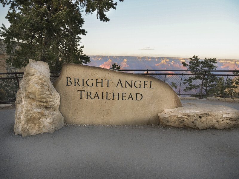
As far as the word Kaibab itself, well, there doesn’t seem to be a known meaning of it on the internet. It is probably a Paiute Native American word and it’s attached to many things in the Grand Canyon area. There is the Kaibab National Forest, which is home to a herd of large antlered deer (well fed and well managed), there is the Kaibab squirrel which is nearly extinct but still holding on, there is the large Kaibab Plateau north of the canyon and, of course, the Kaibab Trail with its South and North branches. Our descent will be on the South Kaibab Trail, and that is for another post.

map of Grand Canyon National Park

Don’t forget to check out the Grand Canyon on Google Earth. It’s amazing!

Journey

The Journey, Getting There from Here

Although I haven’t taken this Grand Canyon hike yet, I have had to figure out how to get there. I did this quite some time ago to make sure that my reservations were in place.  For me, the hike itself was quite an investment and I didn’t want to risk not being there at the right time.

Driving by land is an obvious good choice. My brother and his wife who live about three hours from me, in Wisconsin, are driving and have room in their vehicle for all our equipment.  I am flying out and meeting them before the hike and will be traveling light. Since there are many great places to visit between Wisconsin and Arizona, including many national parks, my brother will be taking his time and may do some other shorter hikes on the way.

Flying into the Grand Canyon area usually means going to one of the nearby cities with an airport – Flagstaff, Phoenix or Las Vegas. Although there is a small airport in Grand Canyon Village, service there is  limited to private and charter flights. From the cities, car rental is the advisable travel means. My brother’s approach will be from the east which meant that Flagstaff was the most logical choice for me. It is, more or less, on his way to the canyon. We will meet in Flagstaff and drive to Grand Canyon Village the day before our trip starts.

Did I make it easy enough to see where the cities with airports are?

Our first day of the hike requires us to be present at 10 am, so we have arranged lodging in Grand Canyon Village on the South Rim within the National Park. It is a small village and has limited year-round lodging. There are a dozen or more hotels including Bright Angel Lodge, El Tovar Hotel, Kachina Lodge, Thunderbird Lodge, the Motor Lodge and Yavapai Lodge. These hotels have been hosting visitors since the park became a tourist destination and several of them are quite famous. El Tovar is right on the Rim and built like a European castle!  Lodging is also available on the North Rim and at Phantom Ranch inside the canyon, which I will mention in a future post.

My brother was able to get a hotel room, but I was not. Instead, I have reservations at Mather Campground in Grand Canyon Village. I will be tenting the night of our arrival, the first night of the hike before the descent, the two nights at Phantom Ranch, and the night after we return to the South Rim. Hopefully, I can survive five nights of sleeping on the ground.

My airport nearest my home is 240 miles away in Minneapolis so I have transportation complications on that end as well. I will probably travel there the night before the flight and do a park and fly stay at a motel. Living in the wild of northern Wisconsin has its aggravations…

There is so much more that I could say about getting to the various destinations in the Grand Canyon. I didn’t even mention much about the North Rim or the West Rim. It’s a big place.

Indians

Indians or Native Peoples of the Grand Canyon area

My first visit to a pueblo was several years ago at Mesa Verde in Arizona.  Pueblos are multi-room dwellings made of clay and the ones at Mesa Verde were built in the clefts of a canyon wall. The native people who lived there were most likely Anasazi, who left the area in the 1300’s A.D. during years of drought. They vanished, leaving behind these remarkable dwellings. They were named Anasazi, or Ancient Ones by the Navajo people north of the canyon.  It is an amazing place to visit.

There were different tribes of the pueblo peoples who inhabited the Grand Canyon, most of whom were semi-nomadic farmers and hunter gatherers. They traveled back and forth from rim to lower canyon to rim, depending on the season. Many of their trails are still present and used by visitors. Indian Gardens is a campground on the Bright Angel Trail but was once an area farmed by the Havasupai tribe.

Presently, one place to experience Native American culture is on the Havasupai Reservation in Havasu Canyon. That is one part of the canyon that my brother has not visited yet and still hopes to. We tried to get reservations to visit there last year but could not. The Havasupai have their own tourist bureaus and quotas of visitors. I love what their name means – “people of the blue-green water”.  They and the Walapai tribe (“people of the pine tree”) live in the western region of the South Rim.

The Grand Canyon Skywalk, on what is called the West Rim of the canyon, is actually on the Hualapai Reservation and outside of Grand Canyon National Park. It is an amazing cantilever bridge, out from the cliff in a horseshoe shape, and 4000 feet above the canyon floor.  Add to that a glass walkway and you have a real tourist attraction.  I have seen pictures of people who became paralyzed with anxiety as they looked down and had to be carried off the walkway. 

There is a lot of controversy within the Hualapai tribe and outside of the tribe concerning this bridge. There are people on the environmentalist side who aren’t sure it’s a good way to preserve the canyon. There are others on the practical side who feel the bridge is a way to raise money for serious needs of the tribe. It’s complicated.

The Hopi people live in the eastern section of the South Rim, and to the southeast are the Zuni tribes. North of the canyon is the Paiute Reservation in the west and the Navajo Reservation in the east. The Navajo were latecomers to the region and lived in the canyon itself only in the 1860’s when being pursued by the U.S. Cavalry. In addition to farming and herding, many of the tribes are craftsmen/women in cloth weaving, basketry, pottery and jewelry making.  You’ve probably heard of Navajo blankets and rugs, right?

Fletcher, Colin

Fletcher, Colin – writer and hiker

I’m including a post about Colin Fletcher, yes, because his last name begins with F, but also because he was somewhat famous for hiking. In spite of being interested in hiking for quite some time, I had never heard of Mr. Fletcher, so I was surprised and intrigued to find out that he’s considered the grandfather of backpacking. He was one of the first persons who thought long and hard about where he was hiking, how to get there and what to take along. His book “The Complete Walker”, a sort of hiker’s bible, has sold over 500,000 copies and is still in print. So, as a result of studying up on him, I now have a new reading list that I can’t wait to get into! See it at the end of this post.

Fletcher was born in Wales, educated in England and did time in the military in World War II. He also spent time teaching in a Mountain Warfare Training Camp and living in Africa, surveying and helping to build roads. He did some prospecting in Canada, which led to a move to San Francisco in 1956. He hiked the nearby mountains. By this time, exploring and getting out alone into the wilderness was in his blood.

This is funny. His first extended backpacking trip in 1963 was from Mexico to Oregon, all along the eastern coast of California. He did what he called “contemplative walking”.  According to the NYT obituary, he took this hike to think over whether or not to marry his girlfriend. He did end up marrying her but it only lasted a few weeks. He probably should have taken a longer hike and contemplated more.

Daughter Julia and I are out for a “contemplative walk”.

He wrote his first book about this experience and called it “The Thousand Mile Summer”.

His second book, “The Man Who Walked Through Time” was written about his hike from one end of the Grand Canyon National Park to the other. He was the first to do the complete length in one hike.  The park at that time didn’t include the entire canyon but it was 200 miles in length. Apparently, with all the zigzags and explorations, he walked closer to 400 miles.

Not many have done this hike even today. It is incredibly difficult to cross the many deep tributary canyons. In an interview with NPR, Chip Rawlins, who co-authored the latest edition of Fletcher’s book “The Complete Walker”, said that Fletcher had devised a sort of life vest that would float him across some of the rivers he had to cross.  One of Rawlins friends, a river guide, said Fletcher must have been “nuts”. Here is a quote from “The Man Who Walked Through Time”:

“I saw that by going down into that huge fissure in the face of the earth deep into the space and the silence and the solitude, I might come as close as we can at present to moving back and down through the smooth and apparently impenetrable face of time.”

The Man Who Walked Through Time, by Colin Fletcher

Colin Fletcher also traveled the complete length of the Colorado River, from source to sea, when he was 69 years old. His book “The River” is said to have his reflections on growing older.  It sounds like all of his books, in addition to having detailed guidelines on wilderness backpacking (solo), have a lot of philosophical musings. A bonus, all of the reviews say his writing is witty and enjoyable as well. I can’t wait to read these books!

The Thousand Mile Summer (1964)

The Man Who Walked Through Time (1968)

The Complete Walker (2002 edition)

River: One Man’s Journey Down the Colorado, Source to Sea (1997)

Elevation!

Yes, ooh aah!

I am not going to give a lot of statistics on elevation in this post. What is significant about elevation, as you would expect, is that this is a very deep canyon. Viewed from the rim, the Colorado River at the bottom looks like a tiny ribbon when, in fact, it is quite wide in all the places that you can see it.

Standing at various lookouts on the rim during my first brief trip, I remember feeling that rush looking out over the cliffs. You almost can’t help but think of what it would be like to fall, or jump. The drops are so extreme.  ( I was saddened to hear the news last week of a tourist who fell to his death. Taking pictures can be hazardous. )

The rims vary from 6000 to 8500 feet above sea level. The drop down to the river at the bottom of the canyon varies from 3500 to 6000 feet. Our gain/loss of elevation on Day 2 and Day 4 of the hike will be about 5,000 feet. That is enough difference in elevation to produce a climate change. It is often much cooler up on the rim and quite warm to very hot at the bottom.

That might make it tricky to pack the right clothing. In May, when I am going, it should not be oppressively hot at the bottom and hopefully, it won’t be snowing up on the rim.

This is what I can expect for May weather:

South Rim (where we start) Max 70 degrees, Min 39 degrees, Precip 0.66 inches

Inner Gorge (lowest point) Max 92 degrees, Min 63 degrees, Precip 0.36 inches

One very curious fact – the plateaus on both sides of the canyon are higher than the elevation upriver. Why did the path of the river run from low to high elevation when it first began cutting the Grand Canyon? Of course, it didn’t. There are several theories about why it appears this way. None of them are certain. Geology is sometimes very strange and although it has stories to tell, we don’t understand them all.

I will end with a picture of one of the bridges that we will cross at the bottom of the canyon – a bridge that still seems scary high, even though it is dwarfed by the walls of the canyon.

It’s difficult to see but there is a mule train crossing the Black Bridge to Phantom Ranch. This footbridge has a solid floor to keep the animals from looking down and freaking out.

Colorado River

Colorado River – I have a huge poster of the Grand Canyon, a gorgeous picture, that I bought on that first, brief trip past the canyon. Since then I’ve learned that it’s actually the book cover of “Time and the River Flowing” by Francois Leydet. The book is full of photos of the canyon, and quotes and stories from its explorers. The “river flowing” is the Colorado River, and I thought I should know something about it before the hike.

Beautiful pictures with quotes and excerpts from those who have written about the river from the conservationist viewpoint.

It’s easy to get overwhelmed by facts and numbers about this river, because there are so many. Here are a few that I found informative:

  • It’s one of two major rivers that cross the southwest of our country, the Rio Grande being the other one.  
  • It’s part of amazing scenery everywhere it runs as evidenced by the 11 national parks that it goes through.
  • It starts in the Rocky Mountains of Colorado where 90% of its water is snow melt, the rest coming from tributaries along the way.
  • It’s a very managed river in that there are many dams, reservoirs and claims on its water for irrigation of crops.
  • By the time it passes the surrounding crop areas in Mexico, on its way to the Gulf of California, every bit of its flow has been apportioned. The last 100 miles are dry most of the year.
  • There has been much controversy surrounding the building of dams and restriction of the flow. ” The ages have been at work on it, and man can only mar it.” Theodore Roosevelt
  • It used to have a delta and tidal bores much like other larger rivers.
  • It provides the water needs for 40 million people in towns and cities along its course.

The Colorado River was one of the forces creating the Grand Canyon. It’s mind boggling to view the depth and breadth of this chasm and realize that the water, way down there at the bottom, was responsible for this wonder of nature. It took a long, long time. I found this quote that illustrates just how long it took to form the many layers of rock, compared to the time the river has been doing its work.  

  “if the two billion years that have elapsed since the creation of the schists of the Inner Gorge were telescoped into a single day, each minute would represent about 1.4 million years. If the schist formed at 12:01 am of that day, the Paleozoic Era began about 6 pm and ended three hours later. Shortly after 11:00 pm the Mesozoic rocks were eroded away and the Paleozoic strata were uplifted. The Colorado River began to carve the Grand Canyon sometime between 11:45 and 11:58 pm. The entire span of human existence has occurred in the last minute before midnight. “

A Field Guide to the Grand Canyon by Stephen Whitney p.242

I’m told the river is cold, swift and has lots of exciting rapids. We will get to hike along it, perhaps wade in it a little on the day we explore the bottom of the canyon. I can’t wait to see it.

Bright Angel Trail

Bright Angel Trail, I can’t wait to climb this “corridor trail” out of the canyon. It’s the most commonly used trail and its trailhead is at the Bright Angel Lodge in Grand Canyon Village. On my brief visit years ago, I had breakfast at the Lodge and wistfully walked a few yards down this wide, well maintained road, knowing that I had to turn around and go back in a few minutes.

Many hikers go down into the canyon on this trail and because of that it has several places where water and restrooms are located. There is a campground called Indian Gardens about 4.5 miles down. It was used first by the Havasupai Indians for accessing water at Garden Creek. Seasonally they stayed at Indian Gardens. The trail was widened and improved around 1890 and extended all the way to the Colorado River by Ralph Cameron. Wouldn’t you know, he started charging $1 per person to use the trail, plus more if needed water or using the outhouses.

What I wondered was why it was called Bright Angel? For a while it was called Cameron’s Trail for obvious reasons, but later he named it after Bright Angel creek and canyon. And those places got their names from the explorer John Wesley Powell. He thought the creek was delightfully pretty and clean, unlike one farther upriver called Dirty Devil. Yes, Dirty Devil and Bright Angel, makes perfect sense.

Bright Angel Trail is not quite as steep as the other trail we are using to go down into the canyon, but even so, it climbs more than 600 feet per mile on average. The total ascent will be 4,380 feet, about a 10% grade.

The Park Service does not recommend trying to hike down and back out in one day on this trail, especially in the busy summer season. In off seasons it has some cold and windy sections near the top of the south rim, and there might even be snow and ice. Many use it as a day hike to Indian Gardens which is quite do-able. It is rated as a moderately difficult hike and even though water is available I will carry my own as well.  

#AtoZChallenge 2019 Tenth Anniversary blogging from A to Z challenge letter

Adventure!

Adventure. I am always looking for it and will tell you that I think of myself as an adventure loving person. I do. In that regard, I have a bucket list of adventures and experiences that I try to work on every now and then. On my list for this spring is to spend time hiking to the bottom of the Grand Canyon.

Years ago, I drove to a family reunion in the “four corners” region, an interesting geographical area, where four state square corners meet.  There is a monument there explaining that as you look in different directions you are seeing Utah, Colorado, New Mexico, and Arizona from that one spot. It is not far from the Grand Canyon so we added a side trip. We had not arranged any excursions ahead of time and were only able to take a shuttle ride along the south rim, but that was enough. The views from the rim are breathtaking and the thought of starting down that trail was so compelling it has stuck with me ever since. I knew I had to do it, someday.

As it happens, one of my brothers spent summers working at the canyon, in various capacities, when he was younger. It has been one of his favorite places over the years and he has hiked nearly all the main trails. I finally gave up waiting for him to ask me on a hike and begged. It worked.

This year’s A to Z Challenge will cover the inspiration, the preparation, the expectation, and the anticipation of my hike down the South Kaibab Trail, my two nights at Phantom Ranch, and the hike back up on the Bright Angel Trail. Since the hike won’t actually take place until May 14th, I’m planning on adding “participation” notes and pictures to my posts after I return.

There is a lot to consider, a lot to learn before going. We have been planning for months already. My brother is taking good care of me as evidenced by the guided trip he chose for us. It is the Grand Canyon Conservancy’s Take a Load Off: Mule-Assisted Camping 0514. In addition, I’ll be spending a few nights in the Mather Campground on the south rim before and after the hike.

Read along on the next 25 posts and you’ll know how to get ready for it too. You will want to go. It will be an adventure!

And so we start on our adventure!