Oh, What Shall I Wear?

Oh, what shall I wear (that doesn’t make me look like a dork)?

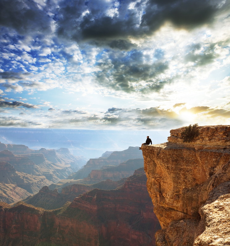
I have photos of all my most memorable hikes. Most of them were taken by me so I am not in them (before selfies) but the ones I am in are always a little embarrassing. Some people look really cool when they’re hiking (and that is SO important) but me, not so much. I just don’t look like I know what I’m doing.

This hike might be different, although I’m not going to bet on it. I’ve had time to prepare and get some real hiking clothes. I justify it more on the practical side so I don’t appear totally vain and superficial. The right hiking clothes do make a difference in comfort, and I have listened to people talk about comfort a lot.

I’ve already shown you about the weather extremes that are possible in May (in post E) so you know that layering on top is going to be important. I also value things that breathe, dry quickly, and are stretchy to allow me to move. I love pants with good pockets, that will not look dirty even if I wear them all three days, and are somewhat water resistant. With these things in mind here is my list.

  • 2 short sleeve T shirts
  • 1 long sleeve T shirt
  • 1 fleece pullover
  • 1 rain jacket (which I might leave behind if the forecast is for no rain)
  • 1 pair convertible pants/shorts
  • 1 pair long pants
  • Socks and underwear
  • Brimmed hat and bandanna
  • Warm hat and gloves

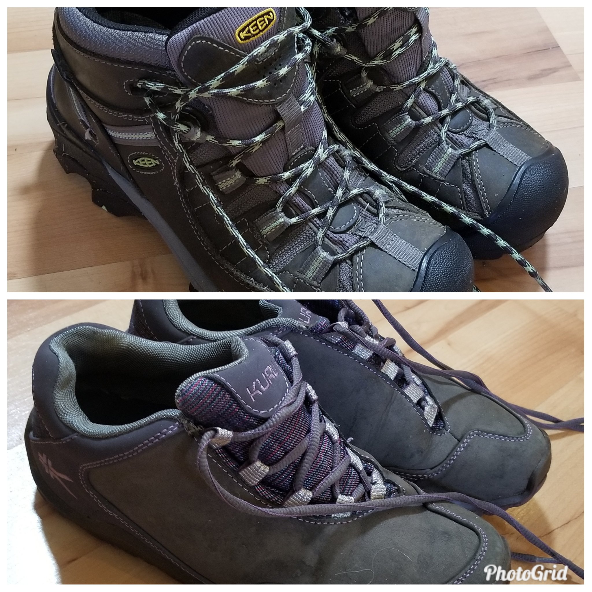
I already wrote about my hiking boots and socks, but I’ll also take along a pair of lightweight camp shoes to give my boots a rest at night.

Actually, I am going to look like a dork on this hike too, because I found this awesome hat that I can also wear all summer in Wisconsin. It will keep the giant mosquitoes and deer flies off my head because it has a bug net that I can lower for ultimate protection.

Front and back selfie – my awesome bug hat.

Another useful purchase for this hike was a set of gaiters. These attach to my boots and come up to my knee to keep my pants and legs clean and dry, and keep debris out of my boots. They are easy to put on and comfortable to wear. I’ve already tried them out – they are good in the snow, an added bonus.

Gaiters

So, what do you think? Am I ready? (ready to look “not cool” in this year’s pictures too?)

Nourishment

A to Z Blogging Challenge, the letter N

(Because we have to eat…)

Eating is a part of hiking that has always interested me. (Actually, isn’t eating a part of almost everything, and what’s not to like about that?) It is challenging to plan for a time when physical demands on the body are great and food is… well, scarce.  On this hike, we will have to pack our meals and snacks for three days, carry fuel and gear to cook the food, and make sure we leave no packaging behind. Some of the food needs to be accessible on the trail as we walk. And, of course, we need to carry enough water for drinking as well as cooking. Here’s our plan.

My brother has some “rations”, dried meals, that he wants to use for the nights when we will be in camp. These will be simple, just add hot water and stir, meals that are designed to be high in calories and electrolytes. We know we will be hungrier than usual and the recommendation is to increase our calorie intake by half – 3,000 calories per day at least.  Other than these two evening meals I don’t plan to have to heat anything – that will mean less fuel to carry and less time spent cooking.

Dried or dehydrated meals are really great because they are light.  Our guidelines say our food for the day should only weigh between 1 and 1.5 pounds. If it’s heavier than that, it isn’t the right food.  

The noon meals while hiking will be short stops, so I want to take tuna or chicken in foil packs, and some kind of cracker. We will also be snacking on trail mix, nuts, Kind bars, and dried fruit. I tend to like salty foods rather than sweet while hiking because I know I need the electrolytes. Sodium is especially important to avoid dehydration (see my D post for more on that). Another way I’m going to watch my electrolyte balance is by putting powder Gatorade or similar drink mix in my water.  The flavor helps me drink more of it too.

packaged trail mix
Jumbo bag to be split up into zip-locks and carried for snacks on the go.

Other than the foil packs for the dried meals and the tuna/chicken meals, I want to repackage my snacks in zip-locks so I don’t have wrappers to dispose of. I can use the zip-locks to hold whatever trash I do have to haul out. 

Our food guidelines included a few other tips such as:

  • Include some spicy sauces to add to bland foods like rice or instant dried beans
  • Hot cereals are great for breakfast if you have time to boil water
  • Dry instant milk, dried meat like turkey or beef jerky are other dehydrated foods that work well
  • Granola gives some crunchy variety to breakfast or snacks
  • Avoid anything in a can – heavy and you have to carry it out too
  • Avoid fresh fruit that will get bruised, or affected by the heat

Just thinking about all this dried stuff makes me hungry and thirsty for fresh vegetables and fruit and something cold to drink. And that brings me to the final part of the hiking experience that I look forward to – the meal after the return to civilization.  Deprivation heightens appreciation, just sayin’…

Mules…

Thank you, Mule.

I’ve mentioned already that this hike, sponsored by the Grand Canyon Association Field Institute, is titled “Take a Load Off: Mule Assisted Camping 0514”.  My brother was being thoughtful of me and his wife, thinking that we would be better off having assistance from some friendly mules. The mules have agreed to carry a duffel bag for each of us which will lighten our load considerably.

On our first day we will meet at about 10 am to have our equipment checked over by our guide, and then our tenting equipment, some of our food and clothing – basically anything we don’t need on the descent – will be packed in the bag allowed us. I think our mule train will start that afternoon. I’m guessing they will go down the Bright Angel Trail, cross the Colorado on the Black Bridge and stay the night at Phantom Ranch (see this pic of mules crossing scary bridge). Almost everything that goes to Phantom Ranch goes by mule, including supplies for the canteen meals and goods sold in the store. Duffel transport is a common expense for hikers, especially ones going up who don’t want all that stuff on their own backs.

A lot of people ride the mules to Phantom Ranch too but the park video says the people getting off the mules are just as tired and sore as the ones who hiked the trail. Excuse me for laughing, haha. When you don’t ride for hours at a time as a regular thing, that is exactly what happens.  

Our hike guidelines give specific instructions to hikers who might happen to meet a mule train on the trail. We are to back up against the uphill side of the trail and wait quietly until the last mule has passed and is at least 50 feet away. Although the mules are well trained and mostly stick to business, if they are harassed or startled it can result in an accident. It is a real shame when a mule is lost off the trail, as you can imagine. And worse yet if a hiker falls, which is why we are given the uphill side. Lucky us.

Book Cover for Brighty of the Grand Canyon

Mules have a real history in the Canyon. An old children’s book which I read to my children years ago was “Brighty of the Grand Canyon”. It was kind of a history lesson of the prospecting days, when miners traveled the canyon looking for gold, with a mule carrying their provisions. Brighty, the mule, is the star of the book – kind of the Black Beauty of the mule world.  A great book about the canyon, and not just for kids. I loved it. Earlier this month a reader reminded me of this story that she had also read and loved. I’m not sure but I think Brighty might have been a burro (small donkey), which is different from a mule, but close enough for these purposes.

The little corral at Phantom Ranch looks just the same as it did when first constructed in the 1920’s. I’m hoping to hang out there a little and talk to some of the handlers because I’m curious about where the mules come from and how they are trained. I know they are very reliable and sure footed, which makes them a good fit for terrain in the canyon.

Kaibab

I have just been looking at the Grand Canyon on Google Earth. From a distance I could not tell what I was seeing. It was the crooked line of a river made broad by lighter borders unevenly stretching out on either side. Zooming in closer I suddenly saw height and depth. The dark areas were shadow of high cliffs. The light areas were less steep slopes with sparse vegetation. The trails were white lines zig zagging down the descents and they went on and on, seemingly forever, as I followed the route our hike will take.

Google Earth is a unique way of seeing the Canyon – vertically, looking straight down. Although it doesn’t compare to actually being there, it gives a dramatic view of how large and complicated the formations are. Look at it if you can.

I always have a hard time understanding the lay of land from written descriptions but I’m going to try to describe this larger area, and show you where Kaibab fits in. Stick with me here.

A high, mountainous plateau goes from east to west across the northern edge of Arizona. It is bisected by the Colorado as it winds it’s way southwest. It’s hard to believe that the river made such a wide, dramatic gash through the plateau that slopes toward the south. On the north side of the river, from east to west, lie the Kaibab, the Kanab, the Uinkaret and the Shivwits Plateaus. On the south side of the river there is the Coconino Plateau and the Hualapai Plateau.  Hundreds of tributaries run down into the Colorado, cutting their own canyons as they go, especially from the north side.  

The Kaibab Plateau “is covered with a beautiful forest, and in the forest charming parks are found…. The plateau has four months of the sweetest summer man has ever  known.” John Wesley Powell

As far as the word Kaibab itself, well, there doesn’t seem to be a known meaning of it on the internet. It is probably a Paiute Native American word and it’s attached to many things in the Grand Canyon area. There is the Kaibab National Forest, which is home to a herd of large antlered deer (well fed and well managed), there is the Kaibab squirrel which is nearly extinct but still holding on, there is the large Kaibab Plateau north of the canyon and, of course, the Kaibab Trail with its South and North branches. Our descent will be on the South Kaibab Trail, and that is for another post.

map of Grand Canyon National Park

Don’t forget to check out the Grand Canyon on Google Earth. It’s amazing!

Journey

The Journey, Getting There from Here

Although I haven’t taken this Grand Canyon hike yet, I have had to figure out how to get there. I did this quite some time ago to make sure that my reservations were in place.  For me, the hike itself was quite an investment and I didn’t want to risk not being there at the right time.

Driving by land is an obvious good choice. My brother and his wife who live about three hours from me, in Wisconsin, are driving and have room in their vehicle for all our equipment.  I am flying out and meeting them before the hike and will be traveling light. Since there are many great places to visit between Wisconsin and Arizona, including many national parks, my brother will be taking his time and may do some other shorter hikes on the way.

Flying into the Grand Canyon area usually means going to one of the nearby cities with an airport – Flagstaff, Phoenix or Las Vegas. Although there is a small airport in Grand Canyon Village, service there is  limited to private and charter flights. From the cities, car rental is the advisable travel means. My brother’s approach will be from the east which meant that Flagstaff was the most logical choice for me. It is, more or less, on his way to the canyon. We will meet in Flagstaff and drive to Grand Canyon Village the day before our trip starts.

Did I make it easy enough to see where the cities with airports are?

Our first day of the hike requires us to be present at 10 am, so we have arranged lodging in Grand Canyon Village on the South Rim within the National Park. It is a small village and has limited year-round lodging. There are a dozen or more hotels including Bright Angel Lodge, El Tovar Hotel, Kachina Lodge, Thunderbird Lodge, the Motor Lodge and Yavapai Lodge. These hotels have been hosting visitors since the park became a tourist destination and several of them are quite famous. El Tovar is right on the Rim and built like a European castle!  Lodging is also available on the North Rim and at Phantom Ranch inside the canyon, which I will mention in a future post.

My brother was able to get a hotel room, but I was not. Instead, I have reservations at Mather Campground in Grand Canyon Village. I will be tenting the night of our arrival, the first night of the hike before the descent, the two nights at Phantom Ranch, and the night after we return to the South Rim. Hopefully, I can survive five nights of sleeping on the ground.

My airport nearest my home is 240 miles away in Minneapolis so I have transportation complications on that end as well. I will probably travel there the night before the flight and do a park and fly stay at a motel. Living in the wild of northern Wisconsin has its aggravations…

There is so much more that I could say about getting to the various destinations in the Grand Canyon. I didn’t even mention much about the North Rim or the West Rim. It’s a big place.

Hiking Boots

A number of years ago I trained for and participated in a 60 mile walk over three days.  From the first days of training there was emphasis on what we were to wear on our feet. Your shoes will make or break your walk, they told us.

One of our training meetings was held at a retail outlet for a major athletic shoe company. I won my first pair of expensive, properly fitted hiking shoes. To be honest, I didn’t understand what people were talking about when they said their perfectly good appearing shoes had worn out. I wore all my shoes until the soles came off or holes appeared.

That hike taught me how important foot protection is when walking long distances. I had some major blisters. Some people lost their toenails, and others had to drop out of the walk with other foot problems. I made it to the end, but it was challenging.

I have two pair of hiking shoes now, low ones and ankle high ones. I’ve had them for over a year and both pair are pretty well broken in.  I know how they feel and how they perform. I’m not sure which pair I will take to the Grand Canyon, but it will probably be the ankle boots, both for protection and stability.

Keene and Kuru – I probably should have used these for letter K

The steep grade on the descent requires shoes with plenty of room in the toe. With every step I’ll be sliding forward slightly and I don’t want my toes rubbing against the toe of the shoe. I’ve seen the recommendation of finding a shoe that’s comfortable and then buying one half size larger. I didn’t do that with my ankle boots, but I’m hoping with the extra lacing up over my ankle that my foot won’t slide much, if at all. These boots also have a thick sole, water resistant qualities and some breathability. Sometimes I wear them for everyday wear just because they are very comfortable.

I’ve also invested in thin, wool hiking socks that don’t bag or bunch up. They are padded and wick moisture away from my feet. (Cotton absorbs moisture, stretches out, and can chafe, so no cotton.) Guidelines for the hike suggest a thin, polypropylene sock as a liner underneath the wool sock but I haven’t found those yet. The most irritating sock problem is that pair that slides down, step by step, and disappears into my shoe. I’m testing all socks to make sure that doesn’t happen.

Another foot saving precaution I’m going to take is to carry certain items in my first aid kit. I’m taking moleskin to cover any blister that appears. I’m taking a product called Body Glide which is great to prevent chafing anywhere it occurs.

Good stuff to have on a hike.

Guidelines

Generally, I am appreciative of guidelines for adventures like this. Guides are people who have been there, done that. Guidelines are their words given to me to make my trip easier and safer. There is nothing about that to not like.

For this hike, I downloaded several pages of guidelines. I feel like winter has contributed nothing to my level of physical fitness, so the guidelines on training for the physical demands of the hike were… well, daunting at least, terrifying at most.  The tips start out with language like this

“The physical demands of hiking Grand Canyon are in stark contrast to those found in mountain climbing or hiking on relatively flat terrain. The first portion of your trip will be a knee-jarring descent. The climb out will come when your legs are most tired. The atmosphere will become increasingly thin as you near the top (the average South Rim elevation is 7,000 ft.), making it considerably more difficult to breathe.” (I highlighted the scary parts.)

Following this part where they got my attention, were schedules for cardio training, muscular strength training and body/joint flexibility training, the likes of which I have followed NEVER. And that was just a “suitable” workout schedule for general fitness.

This was the next schedule for the month leading up to the hike where a “tougher” training was recommended:

  • Day one: 1.5 hours cardiovascular workout, 30 to 40 minutes lower body strength training
  • Day two: 30 minutes cardio warm up, 30 to 40 minutes upper body training
  • Day three: repeat day one
  • Day four: repeat day two
  • Day five: repeat day one
  • Day six: Day hike at least four hours in duration. Try to simulate the Canyon’s trails by hiking on steep hills wearing hiking boots and back pack.
  • Day seven: Rest

I don’t know. I just don’t know.

And the summation was in bold type: Remember-the fitter you are the more fun you will have and the more you will learn.

I’m pretty sure this guy missed the guideline about staying away from the edges of scary cliffs.

The food guidelines are a subject for another post so I’ll skip them now. Protecting the park itself is important though, so I will mention some of the National Park regulations of interest:

  • Carry out your trash. Burning, burying or leaving trash or toilet paper is prohibited.
  • Wood or charcoal fires of any type are prohibited. Sterno or fossil fuel backpack stoves are permitted.
  • Use of biodegradable or any other type of soap in creeks or camping within 100 feet of any water source (except at designated sites) is prohibited.
  • Feeding, touching, teasing, or intentionally disturbing wildlife is prohibited.
  • Throwing or rolling rocks or other items down hillsides or mountainsides, into valleys or canyons, or inside caves is prohibited. 
  • Leaving a trail or walkway to shortcut between portions of the same trail or walkway, or to shortcut to an adjacent trail is strictly prohibited.
  • Possessing, destroying, injuring, defacing, removing, digging, or disturbing from its natural state any plants, rocks, animals, mineral, cultural or archeological resources, natural features, or signs is prohibited. Walking on, entering, traversing, or climbing an archeological resource is prohibited.
  • Traps and nets are prohibited. A valid fishing license is required for all fishing.
  • Because of their sensitive and sometimes dangerous nature, entry and/or exploration of any caves or mines must be approved in advance through Grand Canyon N.P.

I can imagine how all these rules became necessary, and what a job it must have been (much like parenting) to figure out all the words that would have to be used to cover all the excuses people would make.

The thought of carrying out used toilet paper is not pleasant but then neither is the thought of seeing someone else’s used toilet paper stuck on a cactus or sticking out from under a rock. I can see their point. Good to know. I can keep these rules. Just sayin’, how hard can it be?

Fletcher, Colin

Fletcher, Colin – writer and hiker

I’m including a post about Colin Fletcher, yes, because his last name begins with F, but also because he was somewhat famous for hiking. In spite of being interested in hiking for quite some time, I had never heard of Mr. Fletcher, so I was surprised and intrigued to find out that he’s considered the grandfather of backpacking. He was one of the first persons who thought long and hard about where he was hiking, how to get there and what to take along. His book “The Complete Walker”, a sort of hiker’s bible, has sold over 500,000 copies and is still in print. So, as a result of studying up on him, I now have a new reading list that I can’t wait to get into! See it at the end of this post.

Fletcher was born in Wales, educated in England and did time in the military in World War II. He also spent time teaching in a Mountain Warfare Training Camp and living in Africa, surveying and helping to build roads. He did some prospecting in Canada, which led to a move to San Francisco in 1956. He hiked the nearby mountains. By this time, exploring and getting out alone into the wilderness was in his blood.

This is funny. His first extended backpacking trip in 1963 was from Mexico to Oregon, all along the eastern coast of California. He did what he called “contemplative walking”.  According to the NYT obituary, he took this hike to think over whether or not to marry his girlfriend. He did end up marrying her but it only lasted a few weeks. He probably should have taken a longer hike and contemplated more.

Daughter Julia and I are out for a “contemplative walk”.

He wrote his first book about this experience and called it “The Thousand Mile Summer”.

His second book, “The Man Who Walked Through Time” was written about his hike from one end of the Grand Canyon National Park to the other. He was the first to do the complete length in one hike.  The park at that time didn’t include the entire canyon but it was 200 miles in length. Apparently, with all the zigzags and explorations, he walked closer to 400 miles.

Not many have done this hike even today. It is incredibly difficult to cross the many deep tributary canyons. In an interview with NPR, Chip Rawlins, who co-authored the latest edition of Fletcher’s book “The Complete Walker”, said that Fletcher had devised a sort of life vest that would float him across some of the rivers he had to cross.  One of Rawlins friends, a river guide, said Fletcher must have been “nuts”. Here is a quote from “The Man Who Walked Through Time”:

“I saw that by going down into that huge fissure in the face of the earth deep into the space and the silence and the solitude, I might come as close as we can at present to moving back and down through the smooth and apparently impenetrable face of time.”

The Man Who Walked Through Time, by Colin Fletcher

Colin Fletcher also traveled the complete length of the Colorado River, from source to sea, when he was 69 years old. His book “The River” is said to have his reflections on growing older.  It sounds like all of his books, in addition to having detailed guidelines on wilderness backpacking (solo), have a lot of philosophical musings. A bonus, all of the reviews say his writing is witty and enjoyable as well. I can’t wait to read these books!

The Thousand Mile Summer (1964)

The Man Who Walked Through Time (1968)

The Complete Walker (2002 edition)

River: One Man’s Journey Down the Colorado, Source to Sea (1997)

Elevation!

Yes, ooh aah!

I am not going to give a lot of statistics on elevation in this post. What is significant about elevation, as you would expect, is that this is a very deep canyon. Viewed from the rim, the Colorado River at the bottom looks like a tiny ribbon when, in fact, it is quite wide in all the places that you can see it.

Standing at various lookouts on the rim during my first brief trip, I remember feeling that rush looking out over the cliffs. You almost can’t help but think of what it would be like to fall, or jump. The drops are so extreme.  ( I was saddened to hear the news last week of a tourist who fell to his death. Taking pictures can be hazardous. )

The rims vary from 6000 to 8500 feet above sea level. The drop down to the river at the bottom of the canyon varies from 3500 to 6000 feet. Our gain/loss of elevation on Day 2 and Day 4 of the hike will be about 5,000 feet. That is enough difference in elevation to produce a climate change. It is often much cooler up on the rim and quite warm to very hot at the bottom.

That might make it tricky to pack the right clothing. In May, when I am going, it should not be oppressively hot at the bottom and hopefully, it won’t be snowing up on the rim.

This is what I can expect for May weather:

South Rim (where we start) Max 70 degrees, Min 39 degrees, Precip 0.66 inches

Inner Gorge (lowest point) Max 92 degrees, Min 63 degrees, Precip 0.36 inches

One very curious fact – the plateaus on both sides of the canyon are higher than the elevation upriver. Why did the path of the river run from low to high elevation when it first began cutting the Grand Canyon? Of course, it didn’t. There are several theories about why it appears this way. None of them are certain. Geology is sometimes very strange and although it has stories to tell, we don’t understand them all.

I will end with a picture of one of the bridges that we will cross at the bottom of the canyon – a bridge that still seems scary high, even though it is dwarfed by the walls of the canyon.

It’s difficult to see but there is a mule train crossing the Black Bridge to Phantom Ranch. This footbridge has a solid floor to keep the animals from looking down and freaking out.

Dehydration!

Welcome to Day 4 of the A to Z Challenge. My theme for this year is the Grand Canyon, which I will be hiking this May. As I go through the alphabet I am educating myself about the canyon, the equipment I’ll need and the specific hike I’ll be going on, the Take A Load Off: Mule-Assisted Camping 0514

One day while hiking on the Appalachian Trail I started feeling a little light headed and maybe a little less certain of my footing, on a trail that was rocky and precarious. I was able to make it down to a place where the trail crossed a maintenance road, but couldn’t go any farther. Feeling worse by the minute, I had one of my hiking buddies flag down some rangers in a truck on their way to a campground a few miles further away.

They loaded me up, took me to the campground, helped me set up my tent and gave me some electrolyte tablets to put in my drinking water. That was the end of hiking for me that day. The rest of my group reached the campground before nightfall and joined me. This was my first experience with dehydration. I don’t want to repeat it.

The Grand Canyon, in May when I am going, could have some warm weather. There will often be places without shade. We will be moving and carrying light packs for hours. Dehydration is a serious possibility under these conditions and this is most certainly a place where I don’t want to lose my footing.  Water is scarce there and although there are places on the trail where it is available, we will carry what we need plus some extra. One of my guidebooks says this about the subject:

“Dehydration accounts for more fatalities in the Grand Canyon than any other single cause. Some victims have died with water in their canteens. It’s not enough just to carry water, you must drink it.”

p. 228 of A Field Guide to the Grand Canyon, Stephen Whitney

Great advice. Drink the water. Also, in my hike guidelines, marked as an important note, is the instruction to have sufficient sodium and fluids in the 72 hours before the hike commences. So, no low sodium diet, and make sure that travel time to the canyon does not keep me from drinking plenty of water (not coffee or alcohol).

Here are the symptoms of dehydration. You don’t want to experience these so be on guard: 

  • early on you may have thirst, malaise, irritability, fatigue, flushed skin, and increased pulse
  • leading, later on, to dizziness, headache, labored breathing, tingling, dry mouth, difficulty speaking and walking.
  • It gets worse and then you die.
  • You can recover from mild cases, like the one I had, by resting and drinking as much as possible. Advanced cases take medical intervention.

I will carry three liters of water each day of hiking and drink small amounts frequently, regularly. For me, the easiest way to do this is my water pouch, which I carry in my backpack, with its tubing that comes over my shoulder with a bite valve on the end. It is within inches of my mouth and so handy that I can’t ignore it. I do not plan to miss any of the hike being dehydrated this time. And I certainly don’t want to have to be hauled out in a helicopter, a not uncommon occurrence.

Yes, they standby for emergencies like dehydration.