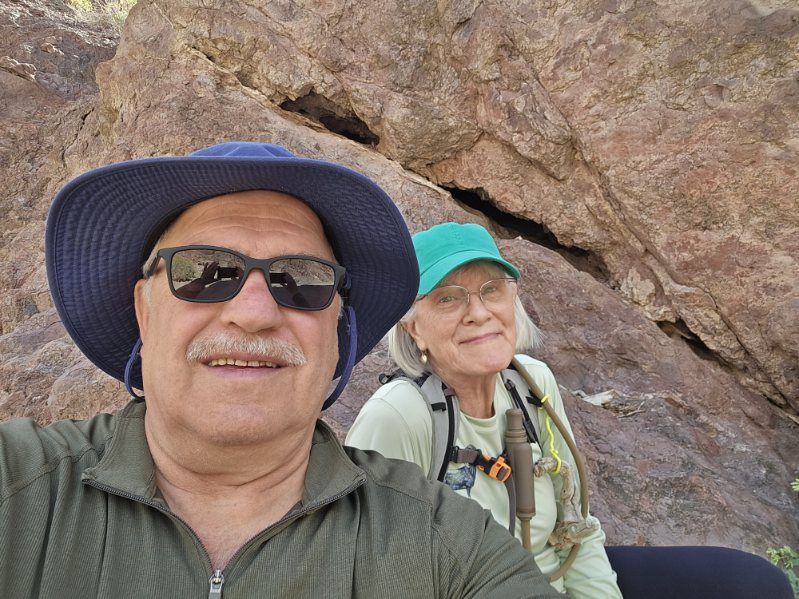
Every year March 4th hits me like a command. March forth and be brave, explore, do something new! That spirit was definitely in play last Wednesday. Gary and Jeannie were gone for a couple of days so Kevin and I decided it was a day to hike. After looking at so many hills and canyons from the truck I wanted to get out there and touch the ground. Kevin and I have bonded over hikes numerous times in Wisconsin and it is one of our favorite things to do together. We chose the Lone Palm Trail. Kevin saw it rated as a moderately difficult path from the trailhead down to the Colorado River. There was a spring at the end, and palm trees. I knew nothing about it but it sounded lovely.
We took some water in my Camelbak, had our heavy hiking shoes on, hats and long sleeved shirts for sun protection. We felt relatively compliant with the scary warning sign at the trailhead. There were no clouds in the sky, no flash flood warnings. What could go wrong?
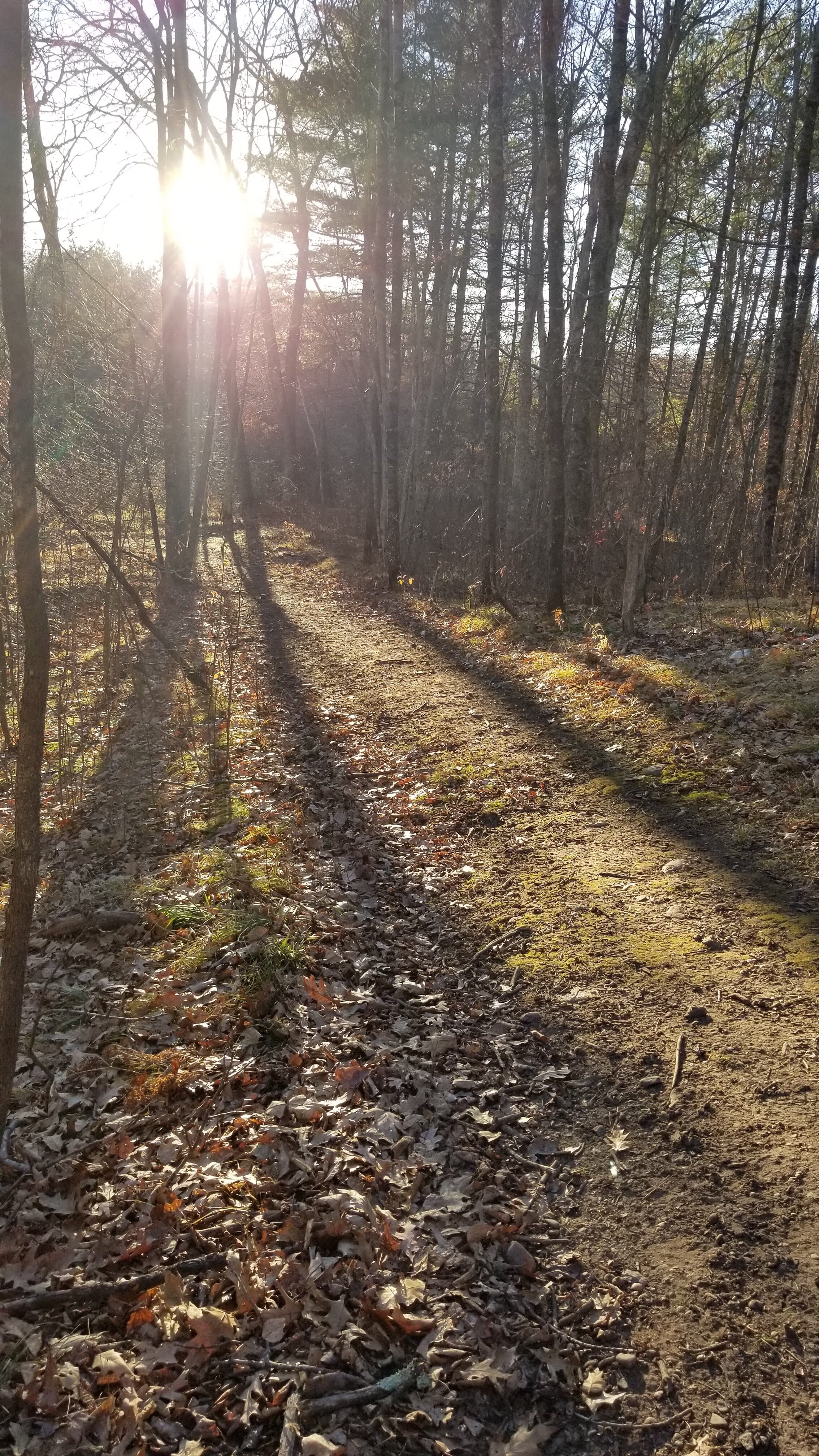
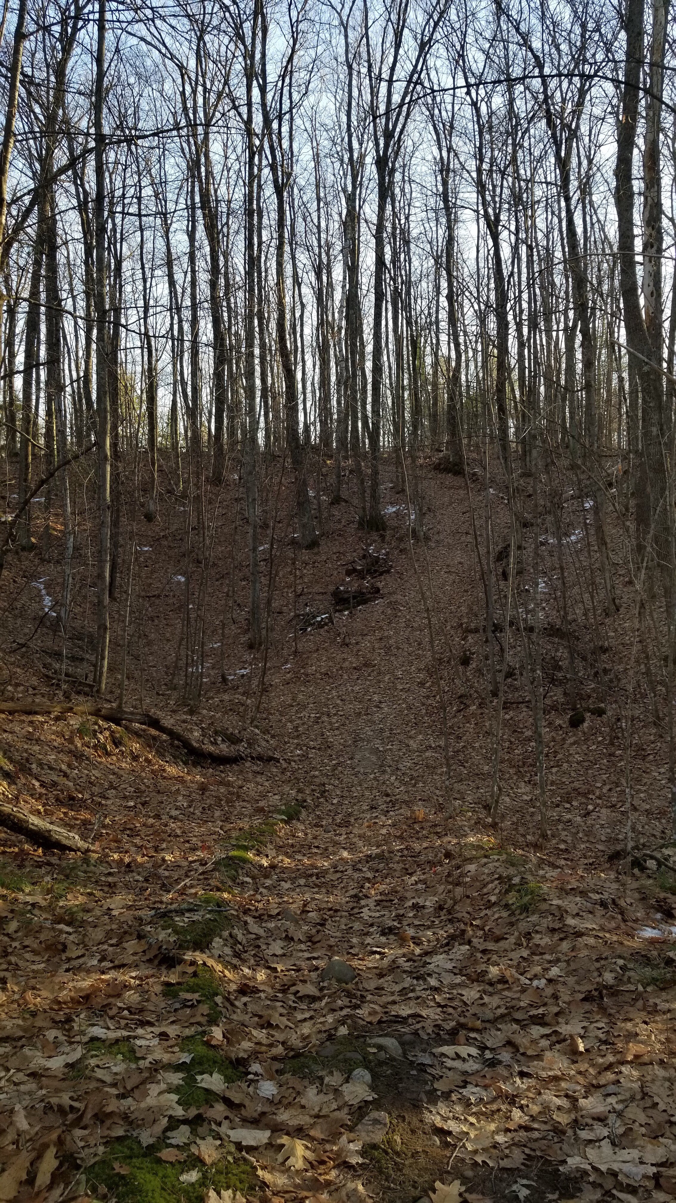
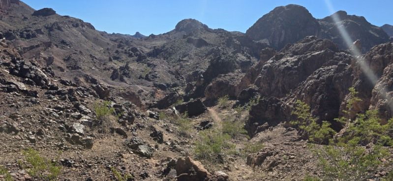
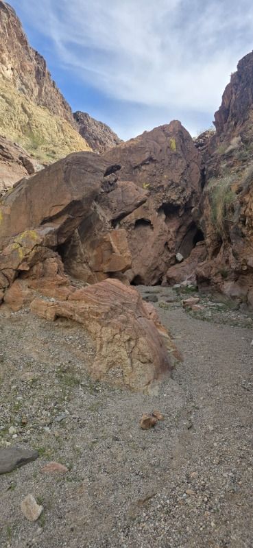
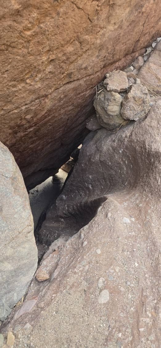
One thing I have learned about the desert and surrounding mountains is that they look much less rugged than they actually are. Sometimes the landscape looks actually flat, because it’s often the same color and texture. You don’t see all the ups and downs, only the tops of features. As we started down the incline and got deeper into the terrain this was the case. The trail wound around the most impassable places. Much of it followed the path of water and was like walking on a dry river bed. High cliffs rose on either side of us. Canyon walls were sometimes close enough to touch on either side, with huge boulders to scramble over. Going over the boulders was not that hard and we continued.
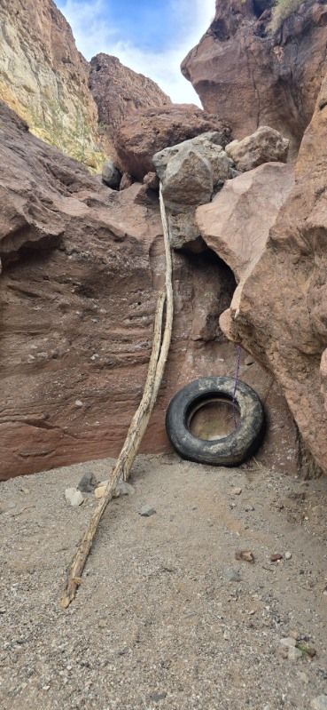
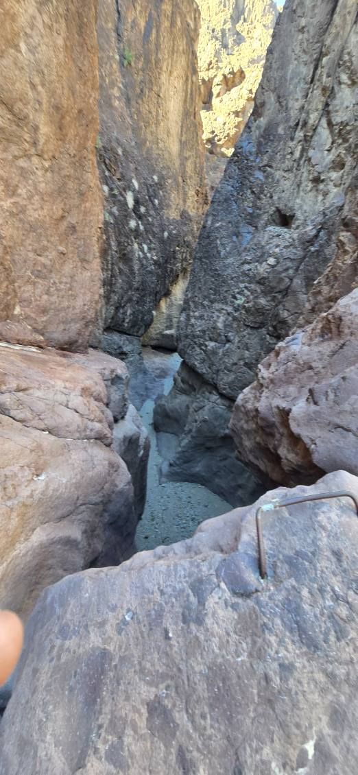
At one narrow point, there was a drop of perhaps six feet that took us by surprise. To aid hikers, someone had taken some sturdy tree branches and propped them into a crevice, like a ladder. It was a little challenging but we got down it. A short while later there was another similar drop, only it was deeper. Not only were there branches to help, but a tire at the bottom for cushioning and a rope fastened in the rock face. Kevin was not too keen on going down this one. I thought it couldn’t be as hard as it looked. Going down always seems easy, especially when I’m still fresh and full of energy. Since this path was a loop, we didn’t have to worry about going back up either. I went down and Kevin did too.
We began to question our map. We would follow what seemed to be the trail, only to find it not passable by normal humans. We backtracked, looking for the arrows spray painted on landmarks. They sometimes took us in directions that seemed wrong, and GPS would show that we were off the trail. But we were still going down so we continued. We started drinking our water.
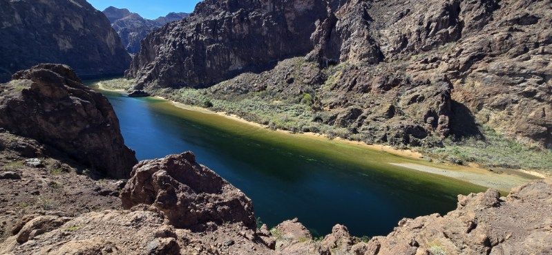
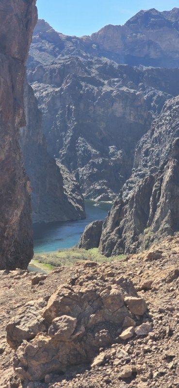
I will now skip to the part where I was getting somewhat tired. We had been hiking for a couple hours and were close to the river. We could glimpse it below us down some steep cliffs. We heard running water and could see a stream and some palm trees. Kevin, up ahead of me, came back and said “We can’t make it down that way. This is the end of the trail for us. We’ll have to go back the way we came.” Not what I wanted to hear.
I was resting on a flat place above the spring and palm trees, trying not to feel dizzy. Kevin joined me. I don’t remember everything he said, but one sentence I remember. “Will you marry me?”
In my head was, “and if I say no are you going to push me off this cliff?” Coming out of my mouth, “Yes, especially if you get me out of here.” I’m sure we will joke about this for the rest of our lives. Maybe he remembers it differently than I do. But the result was that we turned around and hit the trail again as an engaged couple.
We were in the canyon for over five hours. The return trip was pretty slow with frequent rest stops and water breaks. I was seriously light headed. Kevin was beginning to get leg cramps. Prayer for direction and strength was constantly running through my head. I was dreading the rock climbing places, especially the one with the rope. With very little strength left, I did manage the climb. Kevin said it was the scariest part to watch.
The depth of gratitude we felt upon reaching the trailhead is hard to describe. We sat in the truck, drinking water and enjoying the AC and safety. Later we were talking to Kevin’s son-in-law who is a firefighter/paramedic. He said they frequently had to pull people off that trail. Looking at other descriptions of the trail we saw it ranked as challenging/difficult. We agree.
So, we’ve had one more bonding experience. That feeling of being in stressful conditions, but together with someone who has your back was real. We verbally encouraged each other and grabbed a hand when needed. And, like I said, it’s going to be one of our favorite stories to tell.